
Home / Defect reports on a plan
Every defect, pinned where it is.
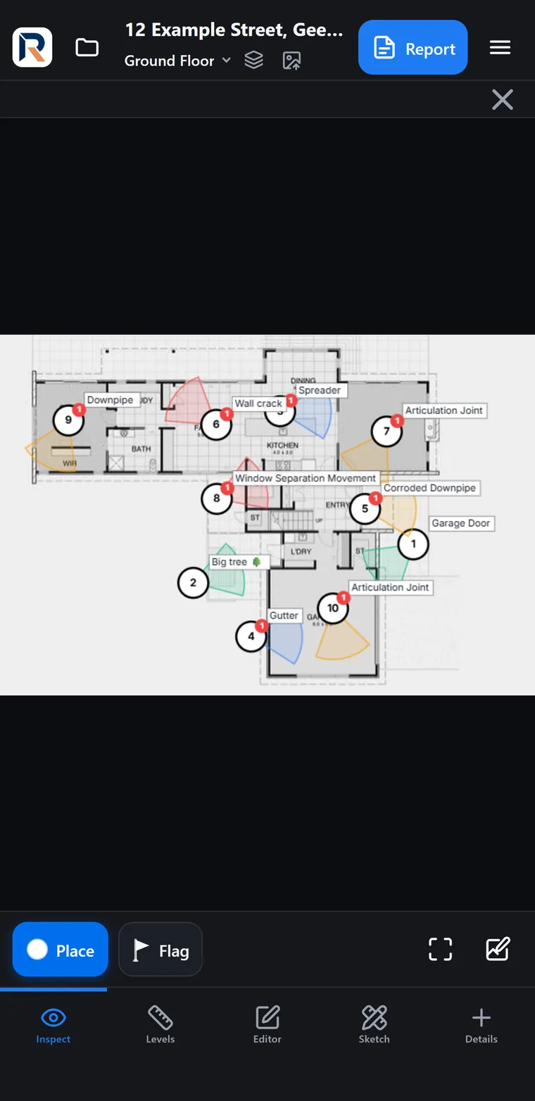
Upload the floor plan, or sketch one on site, and drop a numbered marker where each finding is. The marker points the way the photo was taken, so anyone reading the report can stand where you stood.
Free. Free in the field app. Multiple sections, floor levels, contours and DXF are part of Pro and Expert.
What you get
Upload a plan or sketch one
Use the drawings you have, or sketch the layout on site when there are none.
Numbered directional pins
Each marker shows the direction of its photo, with severity, notes, photos and voice notes.
Record the call you made
Approved, not approved, or approved with conditions, against each finding.
16 annotation tools
Scale, measure, angle, area, callouts and crop, straight over the photo.
Floor levels and contours (Pro)
Spot levels shaded by elevation, contours at your interval, step zones, CSV and CAD (DXF) export.
One section or many (Pro)
A free job covers one section. Pro splits a job into as many as the building needs, one per storey or elevation.
How it works
- Upload the floor plan, or sketch it.
- Tap the plan where each finding is and point the marker.
- Take and mark up the photos, and say what you see.
- Tap Report: send the PDF, export Word, or share it for replies.
Made for
Building defect inspections · Pre-handover · Construction stage · Structural assessment · Floor level surveys (Pro) · Dilapidation
Open a sample report · All sample reports
Questions
Are defect reports on a plan free?
Yes. Uploading or sketching a plan, numbered directional markers, unlimited photos, annotation, voice notes and exports are free in the ReportAI Field App. A free job covers one section.
What does Pro add?
Multiple sections per job, floor levels with contours, step zones, CSV and CAD (DXF) export, and the AI-written summary in the field.
Can I export the levels to CAD?
Yes, with Pro: contours, spot levels, boundary and step zones export as a DXF on separate layers, with the plan attached as an image. Levels and contours are indicative, not survey data.
Can I start without a plan?
Yes. Sketch the layout on site, start on a blank sheet, or use a site walk or site map report instead.
More from ReportAI
- Site map reports (Free): Each finding pinned on a real street or aerial map, inside the work area you outline.
- Condition reports (Free): Rate every element area by area, Good to Damaged, with a photo and a comment where it matters.
- Site walk reports (Free): Walk the site and add a stop wherever you find something. No plan, no map, no setup.
- Defect reports on a plan (Free): Numbered directional pins on your floor plan, with severity, photos, notes and the call you made.
- Share for replies (Pro & Expert): The builder, owner and trades answer their items with notes and photos. Replies come back item by item.
- Online bookings (Pro & Expert): Your own booking page: real free times with travel planned in, prices by the hour, deposits by card.
What is free · Pricing · Start free
Home · What is ReportAI · For homeowners · For builders · Expert witness reports · For organisations · Savings calculator · Pricing · FAQ · About · Find an inspector · Field notes · Contact · Create an account · Sign in · Terms · Privacy · Refunds
reportai.au is a report documentation tool. It does not carry out inspections, does not assess or certify the condition of any building, and does not provide engineering services. Reports are AI-assisted drafts prepared for the inspecting engineer to check, correct, and sign off. All professional judgement remains yours.
Aiman Salem, trading as ReportAi.au · ABN 95 973 765 172 · admin@reportai.au · Prices in Australian dollars.